
Maps are supposed to be stable. They give us a sense of permanence — lines drawn to define territory, measure distance, and record the geography we take for granted. But sometimes, the earth itself has other plans. In a twist worthy of geology’s most dramatic chapters, the devastating Noto Peninsula earthquake earlier this year quite literally redrew the map of Japan.
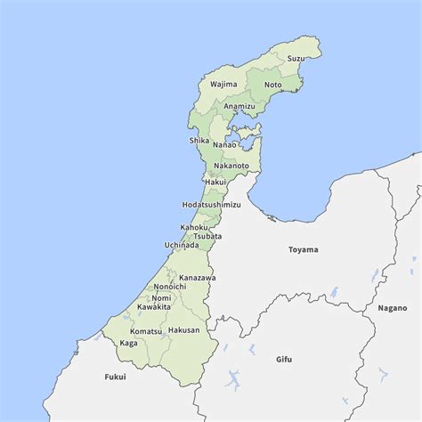
Through seismic uplift, Ishikawa Prefecture’s coastal landmass expanded outward. The result was more than symbolic: Ishikawa now officially surpasses its southern neighbor Fukui in total land area. What might sound like a trivial cartographic detail is, in fact, a rare and profound reminder that natural forces can shift not only the ground beneath our feet but also the political and social frameworks built upon it.
This story is about more than rocks and fault lines. It is about how nature reshapes identity, how disaster leaves behind surprising legacies, and how a single earthquake can ripple through cartography, law, and even the psychology of belonging.
The Earthquake That Changed the Map
The Noto Peninsula earthquake struck with destructive force, flattening homes, severing power lines, and claiming lives. Like many earthquakes in Japan’s history, its immediate legacy was tragedy and loss. But as scientists assessed the aftermath, they discovered something extraordinary: parts of the coast had been lifted above sea level by several meters.
This process, known as tectonic uplift, occurs when seismic activity forces sections of the earth’s crust upward. In Ishikawa, entire stretches of shoreline emerged where water once lapped, creating new beaches, rocky outcrops, and dry land where there had been sea. When surveyors updated their measurements, the change was clear: Ishikawa’s land area had grown. And not just marginally — it had grown enough to surpass Fukui Prefecture, which had long been larger on paper.
This is not just trivia for geography enthusiasts. In a country like Japan, where prefectural identities carry weight and precision matters in everything from land records to taxation, the shift is historic.
The Rarity of Prefectural Shifts
Most natural disasters change landscapes temporarily: landslides block roads, floods reshape riverbanks, tsunamis push water inland. But shifts that alter official political boundaries are exceptionally rare.
Japan’s highly detailed mapping system, managed by the Geospatial Information Authority, is among the most advanced in the world. Its precision means that any measurable change becomes a matter of record. For Ishikawa and Fukui, the earthquake literally forced cartographers to redraw the outlines of prefectural landmass.
Experts note that while earthquakes frequently cause uplift or subsidence, it is unusual for these changes to be large enough to register at the level of prefectural land statistics. The Ishikawa event thus stands as one of those rare cases where geology intrudes directly into administrative geography.
What Uplift Means on the Ground
So what does it actually look like when land rises from the sea? For residents of the Noto Peninsula, the evidence is striking. Fishing boats that once floated easily in harbors now sit awkwardly on dry ground. Piers extend into sandbanks rather than water. Clam beds and tidal pools have shifted, leaving local fishers scrambling to adjust.
Some see opportunity. Newly exposed coastal land could eventually be developed for tourism, walking trails, or marine research. Others see disruption: ecosystems have been altered, fishing grounds have moved, and ancestral shorelines — with deep cultural significance — no longer exist in the same way.
For many locals, the uplift is bittersweet. On one hand, it represents resilience — land literally rising from the depths. On the other, it is a reminder that their lives remain at the mercy of tectonic forces beyond human control.
Cartography Meets Culture
Maps are never just technical documents; they are cultural artifacts. They shape how communities see themselves and how nations project identity. When Ishikawa overtook Fukui in land area, it became more than a line item in a government record. It became part of Ishikawa’s story — and Fukui’s as well.
Prefectural pride in Japan is strong. Each region cultivates its own identity through food, crafts, festivals, and even statistics like population and area. Suddenly, Ishikawa could claim a new superlative: its landmass had grown. For Fukui, once slightly larger, this may be received with quiet humor or resigned acceptance. But in both cases, the event sparks conversation.
Cartographers updating maps, teachers explaining the change in classrooms, or travel agencies reprinting brochures all become part of the cultural transmission of this geologic oddity.
Land Rights and Legal Questions
Whenever land physically changes, legal complexities follow. Who owns newly exposed land? Does it belong to the state, the prefecture, or local communities? Can private citizens claim it if it abuts their property?
Japan has faced these questions before, especially after coastal uplift events or volcanic eruptions that create new islands. Generally, new land formed by natural processes becomes state property. But the nuances can be complicated, especially when it affects livelihoods like fishing rights, tourism access, or infrastructure planning.
For Ishikawa, these questions will play out in town halls and legal offices as officials determine how to incorporate the new geography into existing frameworks. Beyond ownership, there are also environmental considerations: how to protect fragile ecosystems forming on freshly exposed land while balancing human use.
A Silver Lining Amid Tragedy
Natural disasters leave scars, but they also leave legacies. For Ishikawa, the uplift is a reminder that even devastation can produce unexpected gifts. Some residents see the expanded coastline as a symbol of resilience — proof that their land, like their community, has endured and even grown in the face of hardship.
Tourism boards may one day highlight “the earthquake that gave us more land” as a curiosity for visitors. Scientists will study the uplift as a case of real-time geomorphology. Children will grow up with shorelines their parents never knew, and prefectural identity will subtly shift with the new maps.
In this sense, the change is not just geological but psychological. It reframes tragedy as transformation, loss as legacy.
The Science of Uplift
To appreciate the magnitude of Ishikawa’s change, it helps to understand the science. The earth’s crust is divided into tectonic plates that grind, collide, and shift. Along subduction zones like those off Japan’s coast, immense pressure builds as one plate pushes beneath another. When this pressure is released in an earthquake, sections of crust can move dramatically.
In some cases, land subsides, sinking lower and inviting floods or tsunamis. In others, it uplifts, rising above previous sea levels. The Noto Peninsula earthquake produced the latter. Satellite imagery confirmed significant changes in topography, with certain coastal areas elevated by several meters.
This uplift is permanent. Unlike floodwaters that recede, the land has been geologically reset. For cartographers, this means a new baseline. For geologists, it is an invaluable case study of seismic processes in action.
Historical Precedents
Japan’s long history with earthquakes provides some context. The 2011 Tōhoku earthquake, which triggered the Fukushima nuclear disaster, caused parts of the coastline to sink by up to a meter. The 1703 Genroku earthquake near Edo (modern Tokyo) resulted in major uplift along the Bōsō Peninsula.
Globally, similar events have reshaped landscapes. In Chile, a massive quake in 1960 uplifted entire coastlines. In Alaska, the 1964 earthquake raised some areas by nearly 11 meters.
Yet in each case, the social and administrative impact varied. What makes Ishikawa’s event notable is the intersection of precise cartography, modern governance, and prefectural identity. It is one thing for coastlines to shift in rural wilderness; it is another when they shift within a densely mapped, administratively detailed country like Japan.
The Broader Implications
The Ishikawa–Fukui shift is not just a curiosity; it carries broader implications for how we think about borders, identity, and resilience in a changing world.
-
Geopolitical Metaphor – The event is a vivid reminder that human boundaries are temporary impositions on a restless earth. Just as climate change redraws coastlines through rising seas, earthquakes redraw them through sudden uplift.
-
Preparedness and Adaptation – The fact that uplift can alter official statistics underscores the importance of flexible governance. Laws, infrastructure, and disaster planning must account for the possibility that the very ground may change.
-
Psychological Impact – For residents, living in a place that has “grown” carries symbolic weight. It transforms collective memory and local identity, weaving geology into the fabric of culture.
Looking Ahead
In the years to come, Ishikawa’s new landmass will likely fade into the background of daily life. Maps will be updated, statistics adjusted, and residents will adapt. Yet the story will remain a reminder of how fragile our assumptions about permanence really are.
Children in Ishikawa may one day learn that their prefecture became larger not through politics or conquest but because the earth itself rose up from the sea. Tourists may stand on beaches that did not exist a decade earlier, marveling at geology’s handiwork. And geologists will continue to study the uplift, adding Ishikawa’s story to the global archive of seismic transformation.
In this way, the Noto earthquake leaves behind a paradoxical legacy: devastation paired with expansion, tragedy alongside renewal. It is a story both deeply local and universally human — how nature disrupts, reshapes, and occasionally surprises us with gifts we never expected.
Conclusion: When Nature Holds the Pen
The Ishikawa–Fukui land shift is more than a curiosity; it is a lesson in humility. For all our satellites, laws, and technologies, the earth remains the ultimate cartographer. One quake, one uplift, and lines on maps must be redrawn.
For Ishikawa, the new land is a strange silver lining in the shadow of disaster. For Fukui, it is a reminder that even rankings in area are subject to forces beyond human control. For Japan — and the world — it is a symbol of the delicate balance between nature and society, permanence and change.
The next time we look at a map, perhaps we will remember: what seems fixed may not be. Beneath the lines, the earth is always moving, always rewriting. And sometimes, it writes stories stranger than any we could imagine.